Page under construction – Information will be added about the following communities
Yapeen
Yapeen has a population of 300 and is situated 9 km south of Castlemaine on the Castlemaine Maryborough Rail Line. The township is east of the Midland Highway on the Vaughan Springs Rd.
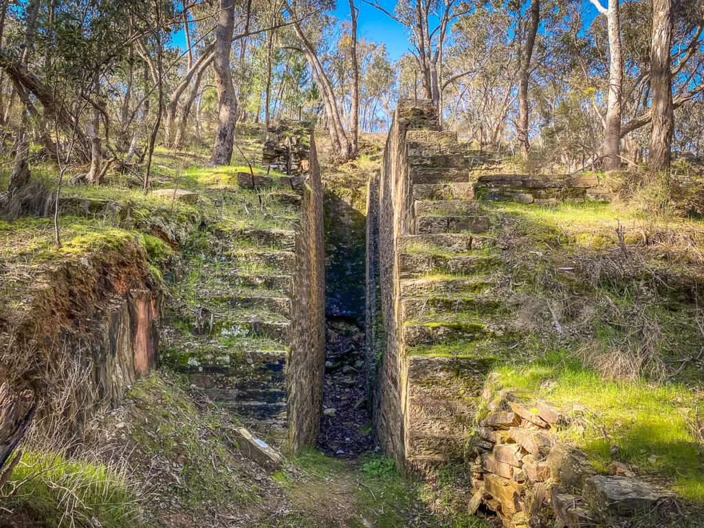
Mopoke Gully Water Wheel near Yapeen
Yapeen didn’t ever have its own railway station but it was only a 1.5 km walk to the Guildford Station. Locals tell stories that, in the days of the Rail Motors providing the passenger service, it was common for the Yapeen locals to flag down the Rail Motor which would stop and pick them up. Walking along the railway line to Guildford Station was dangerous and illegal but was preferred by some rather than walk the sometimes muddy Midland Highway. Two men were killed, in separate incidents in the early 20th century, by trains while walking at night along the track.
Gold was discovered in the area in 1852 and miners flocked to what was known as the “Pennyweight Flat Diggings” in the Mopoke and Donkey Gullies in the hills to the east of town. The sandstone, stepped abutments of the Mopoke Gully Water Wheel (1887) can be found on on Blankett Gully Rd which runs between Yapeen and Campbells Creek. The settlement was named “Yapeen” in 1861, for an Aboriginal word meaning “green hill” or “valley”. Chinese miners were prominent in the area and some later established market gardens.
A school was first established in Yapeen in 1858 with a dedicated school building constructed in 1877. The school closed in 2010
Strangways
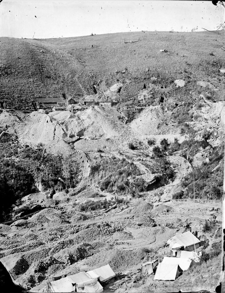
Larni Barramal Yaluk (Jim Crow Creek) Diggings 1858
Strangways has a population of 100 and is situated on the former Castlemaine Maryborough Railway Line 5 km west of Guildford and and 8 km east of Newstead. It is situated on the south side of the Loddon River valley near its junction with the Larni Barramal Yaluk (Home of the Emu Creek) (Formally known as Jim Crow Creek). Strangways was probably named after a British artillery commander Brigadier General Thomas Fox-Strangways, Knight Commander Of The Bath killed at the Battle of Inkerman in the Crimea in 1854.
The original inhabitants of Strangways are the Gunangara gundidj clan of the Dja Dja Wurrung. The Loddon River, its inflows and the rich river valley provided plentiful resources to support their lives. The arrival of European settlers in the 1840’s and their development of sheep farming runs had a devastating effect on the local population of the Dja Dja Wurrung. Their population dropped by about 70% with in a few years.
After the discovery of gold in Central Victoria in 1851, alluvial deposits were found in the Loddon River at Strangways and in its tributaries. Major diggings occurred south of Strangways along the Larni Barramal Yaluk, called Pickpocket Hill and Old Ironstone Hill diggings, and on the Loddon to the north. Chinese miners established a camp with a population of up to three thousand diggers at the junction of Larni Barramal Yaluk (Jim Crow Creek) and the Loddon near Strangways. They also established market gardens along the Loddon.
The town of Strangways grew rapidly with the influx of people associated with the gold rush. Then over the next few decades the population was quite variable depending on the changes in gold digging and later dredging operations. At its peak there were several hotels, with a large hall at the Strangways Hotel, a store, a blacksmith’s forge and churches and a schools. Dredging became on longer economic and ceased in 1954 and following this, the last Strangways school closed in 1964. There is little left of the town today except for ruins .
Strangways railway station opened in 1893 as a platform, siding, small office and shelter. This was replaced by a “Rail Motor Stopping Place” in 1956 which consisted of a platform with a corrugated iron shelter shed. The station was closed in 1977.
Joyces Creek
The foundations of the Joyces Creek settlement and railway station were submerged under the rising waters of the newly created Cairn Curran Reservoir in the early 1950’s. Like ‘Atlantis’ they disappeared into the watery depths. Joyces Creek resident and CMRT committee member, Steve Harrison, uncovers the story. Go to Joyces Creek ‘Atlantis’ Hidden in the Watery Deep.”